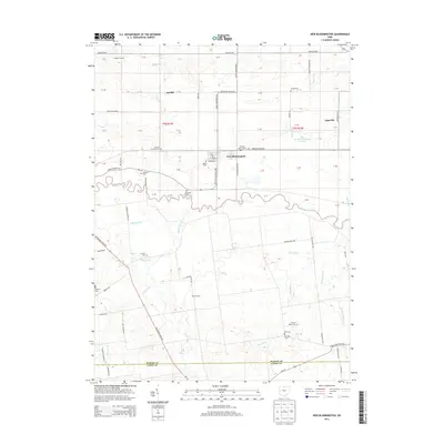
2013 Map of New Bloomington
USGS Topo · Published 2013About this map
The Scioto River meanders across this landscape in western Marion County, defining the agricultural character of the region. The village of New Bloomington sits at a central crossroads, supported by surrounding hamlets such as DeCliff and Espyville. This survey is notably rich in family and community history, recording a high density of rural burial grounds including Salem Cem, Agosta Cem, and Dickason Cem. The land is meticulously drained by an extensive network of man-made waterways like Trey Ditch, Zieg Ditch, and Dudley Run, which support the productivity of the local acreage. In the northeastern quadrant, the Big Island Wildlife Area Reservoir provides a significant break from the grid of farms and township roads. These features collectively illustrate a classic Midwestern rural layout where the natural river path and a strictly surveyed system of ditches dictate the movement of people and the placement of small, lasting settlements.
Find a feature on this map
95 named features on this map. Tap any name to fly to it.
Don’t see what you’re looking for? This feature index may not catch every label — zoom into the map to look around manually.
Map Details
Editions of this 2013 New Bloomington Map
This is the sole edition of this map. No revisions or reprints were ever made.
Other maps of this area

1903 · Marion
USGS Topo · 1:62,500

1905 · Marion
USGS Topo · 1:62,500

1913 · Richwood
USGS Topo · 1:62,500

1915 · Richwood
USGS Topo · 1:62,500

1915 · La Rue
USGS Topo · 1:62,500

1924 · Delaware
USGS Topo · 1:62,500

1925 · Delaware
USGS Topo · 1:62,500

1944 · Richwood
USGS Topo · 1:62,500

1944 · Delaware
USGS Topo · 1:62,500

1950 · Marion
USGS Topo · 1:250,000
Featured Places
- New Bloomington, OH
- Jackson Township, OH
- Montgomery Township, OH
- Big Island Township, OH
- Bowling Green Township, OH