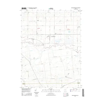
2016 Map of New Bloomington
USGS Topo · Published 2016About this map
New Bloomington and the adjacent settlement of Agosta anchor this central Ohio landscape along the meandering path of the Scioto River. The map reveals a highly managed agricultural and drainage system, evidenced by numerous watercourses like Trey Ditch, Zieg Ditch, and Willow Swamp that feed into the river system. To the north, the Big Island Wildlife Area Reservoir provides a significant break in the grid-like township divisions of t5s r13e and t5s r14e. For genealogists and local historians, the sheet is a dense record of early burial sites, including the German Reform Cem, Hoover Crossing Cem, and the Chapel Cem near Wildcat Pike. Smaller hamlets like Espyville and DeCliff are also documented, alongside vanished rail-related points like Hoover Crossing.
Find a feature on this map
81 named features on this map. Tap any name to fly to it.
Don’t see what you’re looking for? This feature index may not catch every label — zoom into the map to look around manually.
Map Details
Editions of this 2016 New Bloomington Map
This is the sole edition of this map. No revisions or reprints were ever made.
Other maps of this area

1903 · Marion
USGS Topo · 1:62,500

1905 · Marion
USGS Topo · 1:62,500

1913 · Richwood
USGS Topo · 1:62,500

1915 · Richwood
USGS Topo · 1:62,500

1915 · La Rue
USGS Topo · 1:62,500

1924 · Delaware
USGS Topo · 1:62,500

1925 · Delaware
USGS Topo · 1:62,500

1944 · Richwood
USGS Topo · 1:62,500

1944 · Delaware
USGS Topo · 1:62,500

1950 · Marion
USGS Topo · 1:250,000
Featured Places
- New Bloomington, OH
- Jackson Township, OH
- Montgomery Township, OH
- Big Island Township, OH
- Bowling Green Township, OH