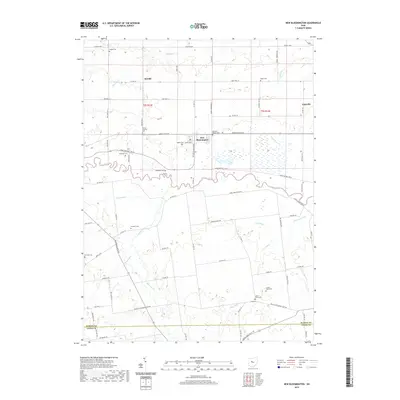
2019 Map of New Bloomington
USGS Topo · Published 2019About this map
New Bloomington serves as a central hub in this Marion County landscape, situated just north of the meandering Scioto River. The area is defined by a dense network of country roads such as Marion-Agosta Rd and Larue Prospect Rd W, which connect scattered small settlements like Decliff and Espyville. This 2019 survey reveals a high concentration of small family and community burial grounds, including the Hoover Crossing Cem, German Reform Cem, and the Cooper Vestal Cem near the southern boundary. The low-lying terrain is shaped by an extensive drainage system of agricultural ditches and creeks, most notably Irey Ditch, Zieg Ditch, and the wetlands of Willow Swamp in the southeast. These features illustrate the transformation of the central Ohio plains into a productive rural landscape through water management.
Find a feature on this map
76 named features on this map. Tap any name to fly to it.
Don’t see what you’re looking for? This feature index may not catch every label — zoom into the map to look around manually.
Map Details
Editions of this 2019 New Bloomington Map
This is the sole edition of this map. No revisions or reprints were ever made.
Other maps of this area

1903 · Marion
USGS Topo · 1:62,500

1905 · Marion
USGS Topo · 1:62,500

1913 · Richwood
USGS Topo · 1:62,500

1915 · Richwood
USGS Topo · 1:62,500

1915 · La Rue
USGS Topo · 1:62,500

1924 · Delaware
USGS Topo · 1:62,500

1925 · Delaware
USGS Topo · 1:62,500

1944 · Richwood
USGS Topo · 1:62,500

1944 · Delaware
USGS Topo · 1:62,500

1950 · Marion
USGS Topo · 1:250,000
Featured Places
- New Bloomington, OH
- Jackson Township, OH
- Montgomery Township, OH
- Big Island Township, OH
- Bowling Green Township, OH