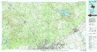
1992 Map of New Braunfels
USGS Topo · Published 1992About this map
San Antonio's northern growth and the surrounding Hill Country are captured in this 1990s-era study, revealing a landscape defined by military installations and emerging suburban corridors. Large federal tracts like the Camp Bullis Military Reservation and Camp Stanley form a significant buffer north of the city, while the University of Texas At San Antonio and San Antonio International Airport anchor the urban edge. This period shows the intensification of the Interstate 35 and Interstate 10 corridors, connecting the regional hub of New Braunfels to smaller settlements like Boerne and Cibolo.
Find a feature on this map
77 named features on this map. Tap any name to fly to it.
Don’t see what you’re looking for? This feature index may not catch every label — zoom into the map to look around manually.
Map Details
Editions of this 1992 New Braunfels Map
2 editions found
Other maps of this area

1887 · Blanco
USGS Topo · 1:125,000

1894 · Fredericksburg
USGS Topo · 1:125,000

1894 · Kerrville
USGS Topo · 1:125,000

1894 · Blanco
USGS Topo · 1:125,000

1896 · Austin
USGS Topo · 1:125,000

1897 · Austin
USGS Topo · 1:125,000

1910 · Austin
USGS Topo · 1:125,000

1911 · San Marcos
USGS Topo · 1:125,000

1919 · San Marcos
USGS Topo · 1:125,000

1920 · Smiley
USGS Topo · 1:125,000