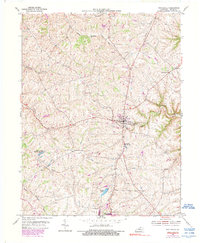
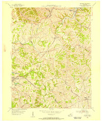
1954 Map of New Castle
USGS Topo · Published 1990About this map
New Castle, the Henry County seat, sits atop a network of branching creek valleys that define the local geography in the mid-1950s. The landscape is marked by the headwaters of several drainages, including White Sulphur Fork, Emily Run, and the winding Fallen Timber Creek. South of the county seat, the community of Eminence borders the southern edge of the survey, featuring Eminence Lake and contributing to a corridor of local growth.
Find a feature on this map
19 named features on this map. Tap any name to fly to it.
Don’t see what you’re looking for? This feature index may not catch every label — zoom into the map to look around manually.
Map Details
Editions of this 1954 New Castle Map
3 editions found
Other maps of this area

1928 · New Castle
USGS Topo · 1:48,000

1932 · New Castle
USGS Topo · 1:62,500

1932 · La Grange
USGS Topo · 1:62,500

1952 · Worthville
USGS Topo · 1:24,000

1952 · Campbellsburg
USGS Topo · 1:24,000

1953 · Bedford
USGS Topo · 1:24,000

1954 · Ballardsville
USGS Topo · 1:24,000
1954 · New Castle
USGS Topo · 1:24,000
1954 · Eminence
USGS Topo · 1:24,000
1954 · Smithfield
USGS Topo · 1:24,000