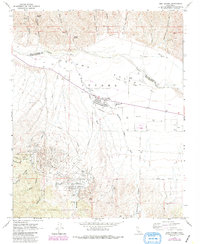
1964 Map of New Cuyama
USGS Topo · Published 1989About this map
The planned mid-century oil town of New Cuyama sits at the heart of this survey, established to support the discovery of petroleum in the Cuyama Valley. The map details the industrial and civic infrastructure of this era, showing the Cuyama Valley High Sch, Richardson Park, and an extensive network of wells and pipelines that crisscross the arid flats. The landscape is defined by the Cuyama River and the dry reaches of Salisbury Wash, which separate the valley floor from the dissected canyonlands to the north and south.
Find a feature on this map
37 named features on this map. Tap any name to fly to it.
Don’t see what you’re looking for? This feature index may not catch every label — zoom into the map to look around manually.
Map Details
Editions of this 1964 New Cuyama Map
3 editions found
Other maps of this area

1902 · Santa Ynez
USGS Topo · 1:125,000

1905 · Santa Ynez
USGS Topo · 1:125,000

1912 · McKittrick
USGS Topo · 1:125,000

1941 · Caliente Mountain
USGS Topo · 1:62,500

1941 · McPherson Peak
USGS Topo · 1:62,500

1942 · Caliente Mtn
USGS Topo · 1:62,500

1942 · East of Cuyama Ranch
USGS Topo · 1:24,000

1943 · McPherson Peak
USGS Topo · 1:62,500

1943 · Caliente Mtn.
USGS Topo · 1:62,500

1943 · Cuyama Ranch
USGS Topo · 1:31,680