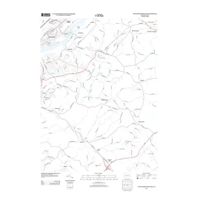
2013 Map of New Kensington East
USGS Topo · Published 2013About this map
The Allegheny River defines the western edge of this landscape, where industrial and suburban development meet the winding creek valleys of Allegheny and Westmoreland counties. The riverfront is anchored by Natrona Heights, Brackenridge, and Natrona, while the Norfolk Southern railroad tracks follow the water's edge, serving the established river towns. Moving inland, the terrain transitions into a mix of residential communities and institutional sites, notably the Alcoa Technical Center at Alcoa Center. Small crossroads like Milligantown and Weinel Crossroads are scattered among the hills, connected by a network of state routes including Pa-56 and Pa-366. The area also features recreational and commemorative spaces such as Greenwood Memorial Cemetery and Oak Hill Golf Course, illustrating the region's mid-century expansion away from the river core.
Find a feature on this map
72 named features on this map. Tap any name to fly to it.
Don’t see what you’re looking for? This feature index may not catch every label — zoom into the map to look around manually.
Map Details
Editions of this 2013 New Kensington East Map
This is the sole edition of this map. No revisions or reprints were ever made.
Other maps of this area

1904 · Mc Keesport
USGS Topo · 1:62,500

1904 · Greensburg
USGS Topo · 1:62,500

1906 · Greensburg
USGS Topo · 1:62,500

1907 · Pittsburg
USGS Topo · 1:62,500

1907 · Freeport
USGS Topo · 1:62,500

1908 · New Kensington
USGS Topo · 1:62,500

1909 · Freeport
USGS Topo · 1:62,500

1910 · New Kensington
USGS Topo · 1:62,500

1953 · Pittsburgh
USGS Topo · 1:250,000

1953 · New Kensington East
USGS Topo · 1:24,000