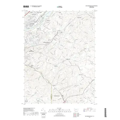
2019 Map of New Kensington East
USGS Topo · Published 2019About this map
The Allegheny River defines the northwestern corridor of this landscape, separating the riverfront communities of Tarentum, Brackenridge, and Natrona from the rising hills to the east. This section of the river valley is a hub of industrial and transport history, where the Norfolk Southern tracks parallel the water, passing beneath the slopes of Edgecliff and Braeburn. Higher elevations are characterized by residential developments and significant institutional sites, including the Pennsylvania State University New Kensington Campus and the Newport Business Institute.
Find a feature on this map
240 named features on this map. Tap any name to fly to it.
Don’t see what you’re looking for? This feature index may not catch every label — zoom into the map to look around manually.
Map Details
Editions of this 2019 New Kensington East Map
This is the sole edition of this map. No revisions or reprints were ever made.
Other maps of this area

1904 · Mc Keesport
USGS Topo · 1:62,500

1904 · Greensburg
USGS Topo · 1:62,500

1906 · Greensburg
USGS Topo · 1:62,500

1907 · Pittsburg
USGS Topo · 1:62,500

1907 · Freeport
USGS Topo · 1:62,500

1908 · New Kensington
USGS Topo · 1:62,500

1909 · Freeport
USGS Topo · 1:62,500

1910 · New Kensington
USGS Topo · 1:62,500

1953 · Pittsburgh
USGS Topo · 1:250,000

1953 · New Kensington East
USGS Topo · 1:24,000