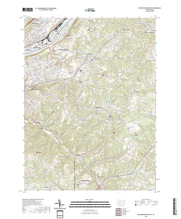
2023 Map of New Kensington East
USGS Topo · Published 2023About this map
Industrial riverfront towns and rolling cemetery-studded hillsides define this portion of the Allegheny River valley northeast of Pittsburgh. The densely settled neighborhoods of Tarentum, Brackenridge, and New Kensington dominate the northwest, where the Norfolk Southern line follows the riverbank past Jacks Island. This modern survey reveals a landscape deeply tied to its faith and community history, evidenced by the high concentration of burial grounds such as Beth Jacob Congregational Cem and Saint Marys Cem. Moving away from the river, the terrain rises into the townships of Lower Burrell and Plum, where institutions like the Pennsylvania State University New Kensington Campus and landmarks like Holtzhauer Lake sit among winding ridge roads. The southern portion of the map transitions into the suburban reaches of Murrysville, marked by rural crossroads like Drennen and Camp Jo-Ann.
Find a feature on this map
204 named features on this map. Tap any name to fly to it.
Don’t see what you’re looking for? This feature index may not catch every label — zoom into the map to look around manually.
Map Details
Editions of this 2023 New Kensington East Map
This is the sole edition of this map. No revisions or reprints were ever made.
Other maps of this area

1904 · Mc Keesport
USGS Topo · 1:62,500

1904 · Greensburg
USGS Topo · 1:62,500

1906 · Greensburg
USGS Topo · 1:62,500

1907 · Pittsburg
USGS Topo · 1:62,500

1907 · Freeport
USGS Topo · 1:62,500

1908 · New Kensington
USGS Topo · 1:62,500

1909 · Freeport
USGS Topo · 1:62,500

1910 · New Kensington
USGS Topo · 1:62,500

1953 · Pittsburgh
USGS Topo · 1:250,000

1953 · New Kensington East
USGS Topo · 1:24,000