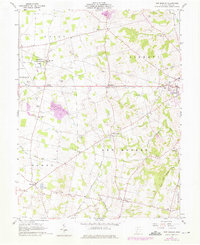
1960 Map of New Market
USGS Topo · Published 1976About this map
The Norfolk and Western railroad corridor cuts across the southwestern corner of this Highland County landscape, passing through Danville and providing a transport link for the surrounding agricultural townships. The area is marked by a dense concentration of family and community burial grounds, including the Old Dutch Cem, Mt Zion Cem, and three separate Fenner No 2 Cem locations, which offer significant data points for genealogical research in New Market and Liberty townships. Near the northern border, the Oldaker State Wildlife Area stands in contrast to the nearby Gravel Pits, illustrating the mixed land use of the mid-20th century. Local landmarks like the Hillsboro Airport and small settlements such as Hoagland and Shackleton define the rural character of the region as it transitioned into the late 1950s and early 1960s.
Find a feature on this map
51 named features on this map. Tap any name to fly to it.
Don’t see what you’re looking for? This feature index may not catch every label — zoom into the map to look around manually.
Map Details
Editions of this 1960 New Market Map
3 editions found
Other maps of this area

1907 · Blanchester
USGS Topo · 1:62,500

1917 · Hillsboro
USGS Topo · 1:62,500

1917 · Sabina
USGS Topo · 1:62,500

1917 · Sardinia
USGS Topo · 1:62,500

1943 · Sabina
USGS Topo · 1:62,500

1944 · Hillsboro
USGS Topo · 1:62,500

1944 · Sardinia
USGS Topo · 1:62,500

1947 · Columbus
USGS Topo · 1:250,000
1960 · Lynchburg
USGS Topo · 1:24,000

1960 · Martinsville
USGS Topo · 1:24,000