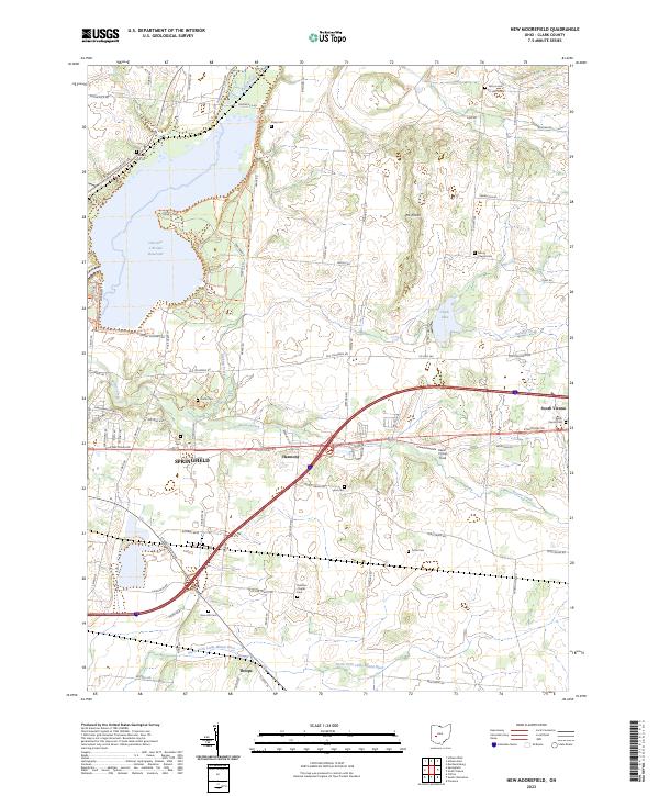
2023 Map of New Moorefield
USGS Topo · Published 2023About this map
The expansive Clarence J Brown Reservoir dominates the northwestern corner of this Clark County landscape, where Buck Creek was impounded to create a large-scale recreational and water management basin. This modern survey illustrates the geographic evolution of the region, where the eastern edges of Springfield meet smaller rural communities like Harmony and South Vienna. The terrain transition is marked by The Knobs, a distinctive topographic feature rising between Sinking Creek and the drainage of Beaver Creek.
Find a feature on this map
124 named features on this map. Tap any name to fly to it.
Don’t see what you’re looking for? This feature index may not catch every label — zoom into the map to look around manually.
Map Details
Editions of this 2023 New Moorefield Map
This is the sole edition of this map. No revisions or reprints were ever made.
Historical Maps of Hollandia View Through Time
3 maps found