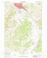
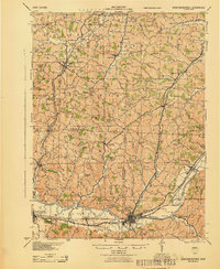
1962 Map of New Philadelphia
USGS Topo · Published 1970About this map
New Philadelphia sits at the heart of this early 1960s survey, showing a landscape shaped by the industrial and transport history of the Tuscarawas River valley. The map documents a transition in infrastructure, noting segments of the Ohio Canal (Abandoned) alongside active corridors for the Baltimore and Ohio Railroad and the Pennsylvania Railroad. To the south, the Schoenbrunn State Memorial preserves the site of early Moravian missionary efforts, while the surrounding townships of Goshen, York, and Warwick are marked by extensive strip mines and industrial activity. Small coal-era settlements like Wainwright and Midvale are detailed alongside numerous rural landmarks, including the St Peters Ch and the Old Town Cem, which offer significant data points for genealogists tracing local families in this portion of the United States Military District.
Find a feature on this map
55 named features on this map. Tap any name to fly to it.
Don’t see what you’re looking for? This feature index may not catch every label — zoom into the map to look around manually.
Map Details
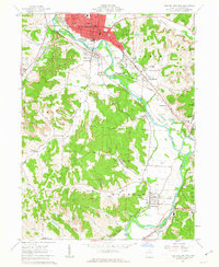
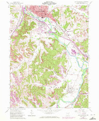
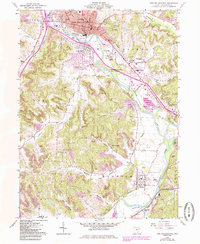
Editions of this 1962 New Philadelphia Map
4 editions found
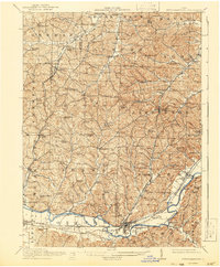
Other maps of this area

1909 · Uhrichsville
USGS Topo · 1:62,500

1911 · Uhrichsville
USGS Topo · 1:62,500

1911 · Newcomerstown
USGS Topo · 1:62,500

1912 · Dover
USGS Topo · 1:62,500
1913 · Newcomerstown
USGS Topo · 1:62,500

1914 · Navarre
USGS Topo · 1:62,500
1943 · Newcomerstown
USGS Topo · 1:62,500

1944 · Navarre
USGS Topo · 1:62,500

1944 · Dover
USGS Topo · 1:62,500

1951 · Canton
USGS Topo · 1:250,000