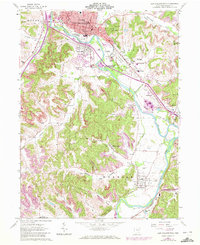
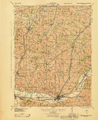
1962 Map of New Philadelphia
USGS Topo · Published 1972About this map
The Tuscarawas River carves a path through this 1960s landscape, serving as the industrial and historical spine for New Philadelphia and its surrounding townships. The map documents a complex overlay of 19th-century infrastructure and mid-century growth, featuring the Ohio Canal (Aband'd) running parallel to the Baltimore and Ohio and Penn Central railroads. These transit corridors fueled the development of outlying settlements like Wainwright, Goshen, and Midvale.
Find a feature on this map
69 named features on this map. Tap any name to fly to it.
Don’t see what you’re looking for? This feature index may not catch every label — zoom into the map to look around manually.
Map Details
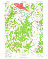
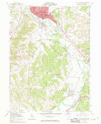
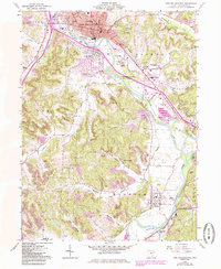
Editions of this 1962 New Philadelphia Map
4 editions found
Other maps of this area

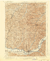
1909 · Uhrichsville
USGS Topo · 1:62,500

1911 · Uhrichsville
USGS Topo · 1:62,500

1911 · Newcomerstown
USGS Topo · 1:62,500

1912 · Dover
USGS Topo · 1:62,500
1913 · Newcomerstown
USGS Topo · 1:62,500

1914 · Navarre
USGS Topo · 1:62,500
1943 · Newcomerstown
USGS Topo · 1:62,500

1944 · Navarre
USGS Topo · 1:62,500

1944 · Dover
USGS Topo · 1:62,500

1951 · Canton
USGS Topo · 1:250,000