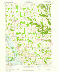
1961 Map of New Pittsburg
USGS Topo · Published 1962About this map
New Pittsburg and Blachleyville anchor this agricultural region in Wayne County, where the landscape is defined by the winding course of Killbuck Creek and the Muddy Fork. The early 1960s economy is characterized by a significant number of extraction points, with numerous Oil Wells and Gas Wells scattered across the townships of Chester and Plain. Transport follows the terrain, notably where the Baltimore and Ohio railroad cuts through the eastern hills near Overton.
Find a feature on this map
30 named features on this map. Tap any name to fly to it.
Don’t see what you’re looking for? This feature index may not catch every label — zoom into the map to look around manually.
Map Details
Editions of this 1961 New Pittsburg Map
2 editions found
Other maps of this area

1901 · Wooster
USGS Topo · 1:62,500

1903 · Wooster
USGS Topo · 1:62,500

1906 · West Salem
USGS Topo · 1:62,500

1908 · West Salem
USGS Topo · 1:62,500

1912 · Loudonville
USGS Topo · 1:62,500

1914 · Loudonville
USGS Topo · 1:62,500

1915 · Millersburg
USGS Topo · 1:62,500

1943 · Millersburg
USGS Topo · 1:62,500

1943 · Loudonville
USGS Topo · 1:62,500

1950 · Marion
USGS Topo · 1:250,000