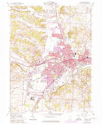
1961 Map of Newark
USGS Topo · Published 1975About this map
Newark serves as the focal point of this mid-century landscape, where the confluence of the North Fork Licking River and South Fork Licking River anchors a dense industrial and archaeological corridor. The map highlights the city's ancient roots through the Octagon State Memorial and Moundbuilders State Memorial, showcasing how these prehistoric earthworks were preserved even as the modern city grew around them.
Find a feature on this map
86 named features on this map. Tap any name to fly to it.
Don’t see what you’re looking for? This feature index may not catch every label — zoom into the map to look around manually.
Map Details
Editions of this 1961 Newark Map
5 editions found

Other maps of this area

1907 · Thurston
USGS Topo · 1:62,500

1908 · Granville
USGS Topo · 1:62,500

1909 · Newark
USGS Topo · 1:62,500

1909 · Thornville
USGS Topo · 1:62,500

1909 · Thurston
USGS Topo · 1:62,500

1910 · Granville
USGS Topo · 1:62,500

1947 · Columbus
USGS Topo · 1:250,000

1950 · Marion
USGS Topo · 1:250,000

1961 · Columbus
USGS Topo · 1:250,000

1961 · Hanover
USGS Topo · 1:24,000