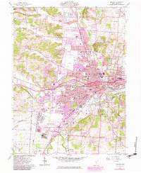
1961 Map of Newark
USGS Topo · Published 1983About this map
The Licking River and its multiple forks converge at Newark, forming a dense network of industry and archaeology. This 1961 survey, updated in the early 1980s, highlights a landscape where prehistoric earthworks like the Octagon State Memorial and Moundbuilders State Memorial sit adjacent to the mid-century expansion of Heath. The industrial character of the valley is evident in the sprawling Oil Refinery and the Newark-Heath Airport, while the outskirts retain rural markers such as the Covered Bridge over Dry Run.
Find a feature on this map
100 named features on this map. Tap any name to fly to it.
Don’t see what you’re looking for? This feature index may not catch every label — zoom into the map to look around manually.
Map Details
Editions of this 1961 Newark Map
5 editions found

Other maps of this area

1907 · Thurston
USGS Topo · 1:62,500

1908 · Granville
USGS Topo · 1:62,500

1909 · Newark
USGS Topo · 1:62,500

1909 · Thornville
USGS Topo · 1:62,500

1909 · Thurston
USGS Topo · 1:62,500

1910 · Granville
USGS Topo · 1:62,500

1947 · Columbus
USGS Topo · 1:250,000

1950 · Marion
USGS Topo · 1:250,000

1961 · Columbus
USGS Topo · 1:250,000

1961 · Hanover
USGS Topo · 1:24,000