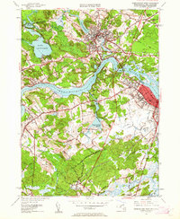
1952 Map of Newburyport West
USGS Topo · Published 1962About this map
The Merrimack River bisects this mid-century landscape, separating the industrial density of Amesbury from the rural hills of West Newbury. This 1952 revision captures a transition in transportation, showing the legacy of the Boston and Maine Railroad alongside developing road networks like Storey Ave. To the north, the Powwow River winds through the heart of Amesbury, past Lake Gardner and numerous local cemeteries including Mt Prospect Cem and Salisbury Plains Cem. The terrain is defined by drumlin-like peaks such as Indian Hill and Crane Neck Hill, which overlook the complex water systems of the Upper Artichoke Reservoir and Lower Artichoke Reservoir. In the southern reaches, the venerable Governor Dummer Academy stands near the Parker River in Byfield, illustrating the deep-rooted educational and civic history of the area.
Find a feature on this map
71 named features on this map. Tap any name to fly to it.
Don’t see what you’re looking for? This feature index may not catch every label — zoom into the map to look around manually.
Map Details
Editions of this 1952 Newburyport West Map
4 editions found
Other maps of this area

1886 · Lawrence
USGS Topo · 1:62,500

1888 · Newburyport
USGS Topo · 1:62,500

1888 · Haverhill
USGS Topo · 1:62,500

1888 · Lawrence
USGS Topo · 1:62,500

1888 · Salem
USGS Topo · 1:62,500

1890 · Haverhill
USGS Topo · 1:62,500

1890 · Newburyport
USGS Topo · 1:62,500

1893 · Salem
USGS Topo · 1:62,500

1893 · Lawrence
USGS Topo · 1:62,500

1893 · Haverhill
USGS Topo · 1:62,500