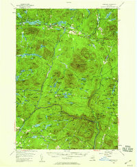
1954 Map of Newcomb
USGS Topo · Published 1959About this map
The Hudson River carves through the central Adirondacks in this mid-century survey, anchoring a landscape of extensive lakes and remote camps. The settlement of Newcomb serves as the primary hub, situated near the Newcomb Cem and the southern shores of Harris Lake and Rich Lake. The area's character is defined by a mix of wilderness preservation and private recreation, evidenced by the presence of the Tahawus Club and Gooley Club, alongside summer retreats like Camp Che-na-wah and Camp Baco.
Find a feature on this map
151 named features on this map. Tap any name to fly to it.
Don’t see what you’re looking for? This feature index may not catch every label — zoom into the map to look around manually.
Map Details
Editions of this 1954 Newcomb Map
5 editions found

Other maps of this area

1895 · North Creek
USGS Topo · 1:62,500

1895 · Mt. Marcy
USGS Topo · 1:62,500

1897 · North Creek
USGS Topo · 1:62,500

1897 · Schroon Lake
USGS Topo · 1:62,500

1898 · Newcomb
USGS Topo · 1:62,500

1898 · Thirteenth Lake
USGS Topo · 1:62,500

1899 · Indian Lake
USGS Topo · 1:62,500

1901 · Newcomb
USGS Topo · 1:62,500

1902 · Mt. Marcy
USGS Topo · 1:62,500

1902 · Indian Lake
USGS Topo · 1:62,500