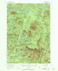
1954 Map of Newcomb
USGS Topo · Published 1972About this map
Harris Lake and the Hudson River anchor this mid-century survey of the central Adirondacks, centered on the settlement of Newcomb. The landscape is defined by its recreation and early timber culture, featuring established retreats like the Tahawus Club and the Northwoods Club, alongside youth camps such as Camp Che-na-wah and Camp Baco. Significant water management is evident at the Goodnow Flowage and Adirondack Flow, while the surrounding summits of Vanderwhacker Mountain and Goodnow Mountain — the latter topped with a Lookout Tower — dominate the horizon. Local history is grounded in the Newcomb Cem and the trail network, including the Wolf Creek Trail and Vanderwhacker Brook Trail, which suggest the area's transition from an industrial logging landscape toward a preserved wilderness within the Adirondack State Park.
Find a feature on this map
131 named features on this map. Tap any name to fly to it.
Don’t see what you’re looking for? This feature index may not catch every label — zoom into the map to look around manually.
Map Details
Editions of this 1954 Newcomb Map
5 editions found

Other maps of this area

1895 · North Creek
USGS Topo · 1:62,500

1895 · Mt. Marcy
USGS Topo · 1:62,500

1897 · North Creek
USGS Topo · 1:62,500

1897 · Schroon Lake
USGS Topo · 1:62,500

1898 · Newcomb
USGS Topo · 1:62,500

1898 · Thirteenth Lake
USGS Topo · 1:62,500

1899 · Indian Lake
USGS Topo · 1:62,500

1901 · Newcomb
USGS Topo · 1:62,500

1902 · Mt. Marcy
USGS Topo · 1:62,500

1902 · Indian Lake
USGS Topo · 1:62,500