
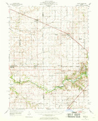
1954 Map of Niantic
USGS Topo · Published 1955About this map
The Sangamon River carves through this central Illinois landscape, defining the southern geography near the Lincoln Homestead Memorial Park and the Lincoln Trail Bridge. In the mid-1950s, this region was a dense network of rail-dependent settlements, with the Illinois Central, Wabash, and Illinois Terminal lines linking towns like Niantic and Illiopolis. The map documents a rural society in transition, noting landmarks like the Brick Sch (Abandoned) and Disbrow Sch (Abandoned) alongside active community centers like Illini Ch and Sharon Ch. Genealogists will find significant value in the numerous family-linked burial grounds, including Twomile Grove Cem, Muirheid Cem, and Lake Bank Cem, which dot the townships of Lake Fork and Harristown. The presence of several gravel pits along the river indicates the local extractive industry that supported road building and construction during this era of post-war growth.
Find a feature on this map
67 named features on this map. Tap any name to fly to it.
Don’t see what you’re looking for? This feature index may not catch every label — zoom into the map to look around manually.
Map Details
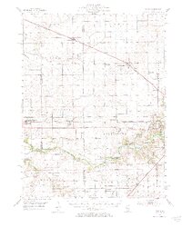
Editions of this 1954 Niantic Map
3 editions found
Other maps of this area

1911 · Lincoln
USGS Topo · 1:62,500

1913 · Lincoln
USGS Topo · 1:62,500

1923 · Taylorville
USGS Topo · 1:62,500

1925 · Taylorville
USGS Topo · 1:62,500

1929 · Decatur
USGS Topo · 1:62,500

1933 · Decatur
USGS Topo · 1:62,500

1949 · Dalton City
USGS Topo · 1:62,500

1952 · Assumption
USGS Topo · 1:62,500

1954 · Mechanicsburg
USGS Topo · 1:62,500

1957 · Kenney
USGS Topo · 1:62,500