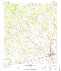
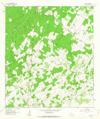
1961 Map of Nixon
USGS Topo · Published 1986About this map
The town of Nixon sits as a regional rail hub in the early 1960s, situated along the Southern Pacific tracks near the confluence of Sandies Creek and Clear Fork Sandies Creek. This survey captures a rural landscape defined by ranching and small-scale industry, where the Wilson Co Gonzales Co boundary line zigzags through rolling ranch lands and creek valleys. Evidence of the local economy is visible in the scattered Claypits and Gravel Pits found throughout the region, particularly near Camp Valley Ch in the northeast.
Find a feature on this map
29 named features on this map. Tap any name to fly to it.
Don’t see what you’re looking for? This feature index may not catch every label — zoom into the map to look around manually.
Map Details
Editions of this 1961 Nixon Map
3 editions found
Other maps of this area

1920 · Smiley
USGS Topo · 1:125,000

1942 · Dewville
USGS Topo · 1:62,500

1953 · Seguin
USGS Topo · 1:250,000

1956 · Dewville
USGS Topo · 1:62,500

1958 · Seguin
USGS Topo · 1:250,000

1961 · Nixon
USGS Topo · 1:24,000
1961 · Stockdale
USGS Topo · 1:24,000
1961 · Thomas Springs
USGS Topo · 1:24,000
1961 · Alum
USGS Topo · 1:24,000

1961 · Gillett
USGS Topo · 1:24,000