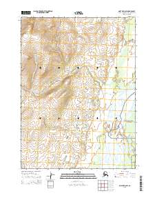
2015 Map of Noatak D-2 SW
USGS Topo · Published 2015About this map
The Mulgrave Hills dominate the northwestern landscape of this sub-arctic terrain, rising above a complex network of waterways in the Northwest Arctic Borough. The drainage pattern here is defined by several prominent streams, including Pingaluruk Cr and Evaingiknuk Cr, which weave through the townships of the public land survey system. Along the eastern edge of the sheet, the Noatak River serves as a primary geographical anchor, marking the boundary of the Noatak National Preserve. This area, also designated as Nnp on the southern margin, remains a landscape primarily defined by its natural hydrology and topographical contours, with Kitchak Cr flowing through the southwestern corner. The map provides a clear record of these protected lands before any significant modern infrastructure altered the drainage basins or ridgelines.
Find a feature on this map
13 named features on this map. Tap any name to fly to it.
Don’t see what you’re looking for? This feature index may not catch every label — zoom into the map to look around manually.
Map Details
Editions of this 2015 Noatak D-2 SW Map
This is the sole edition of this map. No revisions or reprints were ever made.
Other maps of this area

1951 · Noatak
USGS Topo · 1:250,000

1955 · Noatak
USGS Topo · 1:250,000

1955 · Noatak D-3
USGS Topo · 1:63,360

1955 · Noatak D-2
USGS Topo · 1:63,360

1955 · Noatak C-2
USGS Topo · 1:63,360

1955 · Noatak C-3
USGS Topo · 1:63,360

1964 · Noatak
USGS Topo · 1:250,000
2014 · Noatak D-3 SE
USGS Topo · 1:25,000
2014 · Noatak C-3 NE
USGS Topo · 1:25,000
2015 · Noatak D-3 NE
USGS Topo · 1:25,000