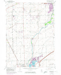
1962 Map of Normantown
USGS Topo · Published 1974About this map
Elgin Joliet And Eastern railroad tracks define the western corridor of this landscape, passing through the small community of Normantown. To the north, Frontenac sits near the Naper Landing Strip, while the southeastern portion of the map shows the extensive Gravel Pits that shaped the local economy near Plainfield. The confluence of the West Branch and East Branch of the Du Page River serves as a central geographic anchor, winding through agricultural land that, by the 1970s, began to show the purple-tinted expansion of suburban Naperville and Lisle.
Find a feature on this map
31 named features on this map. Tap any name to fly to it.
Don’t see what you’re looking for? This feature index may not catch every label — zoom into the map to look around manually.
Map Details
Editions of this 1962 Normantown Map
3 editions found
Other maps of this area

1892 · Joliet
USGS Topo · 1:62,500

1908 · Wheaton
USGS Topo · 1:62,500

1923 · Joliet
USGS Topo · 1:62,500

1925 · Yorkville
USGS Topo · 1:62,500

1932 · Geneva
USGS Topo · 1:62,500

1948 · Wheaton
USGS Topo · 1:62,500

1948 · Geneva
USGS Topo · 1:62,500

1950 · Aurora North
USGS Topo · 1:24,000

1953 · Naperville
USGS Topo · 1:24,000

1953 · Yorkville SE
USGS Topo · 1:24,000