
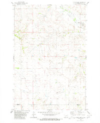
1960 Map of North Almont
USGS Topo · Published 1961About this map
Big Muddy Creek and Curlew Creek wind through the southern hills of Morton County, defining a landscape shaped by both water and rail. During this era of the early 1960s, the Northern Pacific railroad serves as the primary corridor, passing through the small settlement of North Almont. Traces of earlier transportation networks remain visible, including an Old Railroad Grade and an Old RR Grade that cut across the local topography near Ericson Coulee.
Find a feature on this map
23 named features on this map. Tap any name to fly to it.
Don’t see what you’re looking for? This feature index may not catch every label — zoom into the map to look around manually.
Map Details
Editions of this 1960 North Almont Map
This is the sole edition of this map. No revisions or reprints were ever made.
Other maps of this area

1954 · Bismarck
USGS Topo · 1:250,000

1958 · Bismarck
USGS Topo · 1:250,000

1960 · Dengate
USGS Topo · 1:24,000

1960 · New Salem
USGS Topo · 1:24,000

1970 · Bluegrass
USGS Topo · 1:24,000

1970 · New Salem NW
USGS Topo · 1:24,000

1970 · Hailstone Butte
USGS Topo · 1:24,000

1980 · Crown Butte Creek NW
USGS Topo · 1:24,000

1980 · Almont East
USGS Topo · 1:24,000
1980 · Almont West
USGS Topo · 1:24,000