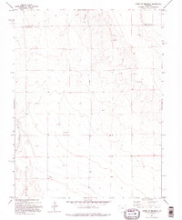
1982 Map of North Of Brandon
USGS Topo · Published 1995About this map
Big Sandy Creek winds along the western edge of this High Plains landscape, marking a distinct drainage pattern in an otherwise high-altitude plateau. Surveyed in the mid-1970s and finalized in 1982, the map depicts the rural border between Cheyenne Co and Kiowa Co. The terrain is defined by its industrial and agricultural utility, shown through a network of infrastructure including a prominent Pipeline and several widely dispersed resource extraction sites. Evidence of small-scale aviation and energy development is clear, with a remote Landing Strip and an Oil Well situated among the various cattle tanks and gravel workings. This map captures the region before modern expansion, preserving the exact placement of local landmarks like the Well and Tank sites that were critical to the local ranching and industrial economy of the era.
Find a feature on this map
8 named features on this map. Tap any name to fly to it.
Don’t see what you’re looking for? This feature index may not catch every label — zoom into the map to look around manually.
Map Details
Editions of this 1982 North Of Brandon Map
2 editions found
Other maps of this area

1890 · Granada
USGS Topo · 1:125,000

1891 · Kit Carson
USGS Topo · 1:125,000

1892 · Lamar
USGS Topo · 1:125,000

1892 · Cheyenne Wells
USGS Topo · 1:125,000

1892 · Granada
USGS Topo · 1:125,000

1893 · Kit Carson
USGS Topo · 1:125,000

1894 · Cheyenne Wells
USGS Topo · 1:125,000

1894 · Granada
USGS Topo · 1:125,000

1954 · Lamar
USGS Topo · 1:250,000

1958 · Lamar
USGS Topo · 1:250,000