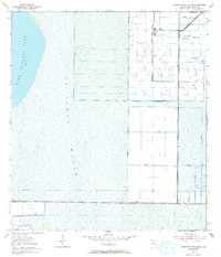
1953 Map of North Of Gum Slough
USGS Topo · Published 1993About this map
The vast expanse of St Johns Marsh dominates this landscape along the Florida-Indian River County line, revealing the complex water management systems of the mid-20th century. Large sections of the terrain are partitioned by an extensive network of Levees, designed to control the inundation of the marsh and manage the waters of Blue Cypress Lake. This infrastructure supported agricultural industrialization, most notably evidenced by the presence of a Sugar Processing Plant situated near the north-central boundary.
Find a feature on this map
9 named features on this map. Tap any name to fly to it.
Don’t see what you’re looking for? This feature index may not catch every label — zoom into the map to look around manually.
Map Details
Editions of this 1953 North Of Gum Slough Map
3 editions found
Other maps of this area

1949 · Fellsmere
USGS Topo · 1:24,000

1951 · Fellsmere
USGS Topo · 1:24,000

1953 · Fellsmere SW
USGS Topo · 1:24,000

1953 · Fort Drum
USGS Topo · 1:24,000

1953 · Fellsmere 4 SE
USGS Topo · 1:24,000

1953 · Fort Drum NE
USGS Topo · 1:24,000

1953 · Fellsmere 4 SW
USGS Topo · 1:24,000

1953 · Kenansville SE
USGS Topo · 1:24,000

1953 · Fellsmere 4 NW
USGS Topo · 1:24,000
1953 · Fellsmere 4 NE
USGS Topo · 1:24,000