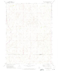
1972 Map of North Platte 2 NE
USGS Topo · Published 1975About this map
The rolling sandhills of western Nebraska define this early 1970s topographic study along the boundary of Mc Pherson and Lincoln counties. Unlike the densely settled agricultural plains to the east, this landscape is dominated by large-scale livestock operations. Named family holdings like the Stoddard Ranch and Rundback Ranch stand out as primary landmarks in a region where few roads penetrate the complex terrain. The map meticulously records the fine red dashed lines indicating fences and field lines, reflecting the vital infrastructure of the ranching economy. Near the southern edge, the Gragg Ranch provides another focal point for local history and land-use patterns during this era. The topography is characterized by intricate contour intervals that reveal the unique drainage and dune formations of the Sandhills region.
Find a feature on this map
4 named features on this map. Tap any name to fly to it.
Don’t see what you’re looking for? This feature index may not catch every label — zoom into the map to look around manually.
Map Details
Editions of this 1972 North Platte 2 NE Map
2 editions found
Other maps of this area

1899 · North Platte
USGS Topo · 1:125,000

1902 · North Platte
USGS Topo · 1:125,000

1949 · Cody Lake
USGS Topo · 1:62,500

1951 · Tryon
USGS Topo · 1:62,500

1951 · Cody Lake
USGS Topo · 1:62,500

1954 · North Platte
USGS Topo · 1:250,000

1956 · North Platte
USGS Topo · 1:250,000

1957 · North Platte
USGS Topo · 1:250,000

1967 · North Platte
USGS Topo · 1:250,000
1972 · North Platte 2 SW
USGS Topo · 1:24,000