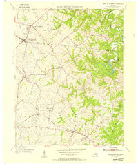
1954 Map of North Pleasureville
USGS Topo · Published 1955About this map
North Pleasureville and South Pleasureville sit along the winding border of Henry and Shelby counties, anchoring a rural landscape defined by the Louisville And Nashville railroad. This mid-century survey illustrates the distinct spatial relationship between these two settlements, with the Consolidated High Sch serving the local community. Further south, the railroad corridor connects the hamlets of Cropper, Christianburg, and Bagdad, where the line runs parallel to the headwaters of Indian Fork.
Find a feature on this map
34 named features on this map. Tap any name to fly to it.
Don’t see what you’re looking for? This feature index may not catch every label — zoom into the map to look around manually.
Map Details
Editions of this 1954 North Pleasureville Map
3 editions found
Other maps of this area

1906 · Lockport
USGS Topo · 1:48,000

1908 · Lockport
USGS Topo · 1:62,500

1922 · Frankfort
USGS Topo · 1:48,000

1923 · Waddy
USGS Topo · 1:48,000

1924 · Frankfort
USGS Topo · 1:62,500

1925 · Mount Eden
USGS Topo · 1:48,000

1927 · Mount Eden
USGS Topo · 1:62,500

1928 · New Castle
USGS Topo · 1:48,000

1932 · New Castle
USGS Topo · 1:62,500

1953 · Gratz
USGS Topo · 1:24,000