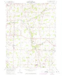
1960 Map of North Robinson
USGS Topo · Published 1974About this map
The upper reaches of the Sandusky River wind through this Crawford County landscape, defining a rural region centered on the village of North Robinson. During this mid-century period, the area maintained its agricultural character, evidenced by the numerous small family and community burial grounds like Windfall Cem, Sandusky Cem, and the Fakvey Cemetery. The transportation network is anchored by the Penn Central railroad, which bisects the townships of Whetstone, Jefferson, and Jackson.
Find a feature on this map
51 named features on this map. Tap any name to fly to it.
Don’t see what you’re looking for? This feature index may not catch every label — zoom into the map to look around manually.
Map Details
Editions of this 1960 North Robinson Map
4 editions found

Other maps of this area

1913 · Mount Gilead
USGS Topo · 1:62,500

1915 · Bucyrus
USGS Topo · 1:62,500

1915 · Crestline
USGS Topo · 1:62,500

1915 · Shauck
USGS Topo · 1:62,500

1916 · Mount Gilead
USGS Topo · 1:62,500

1943 · Shauck
USGS Topo · 1:62,500

1943 · Bucyrus
USGS Topo · 1:62,500

1943 · Crestline
USGS Topo · 1:62,500

1943 · Mount Gilead
USGS Topo · 1:62,500

1950 · Marion
USGS Topo · 1:250,000