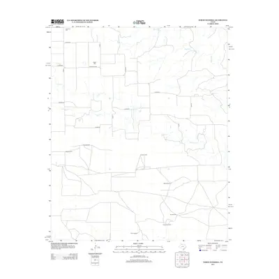
2012 Map of North Windmill
USGS Topo · Published 2012About this map
Wolf Flat serves as a central reference point in this rural Hall County landscape, where the flat, open terrain is defined by an extensive network of ranch roads and remote landmarks. The area's agricultural and livestock-focused character is evidenced by the numerous named windmills scattered across the plains, including North Windmill, Groves Windmill, and Dogtown Windmill. These markers, along with family-named sites like Miller Windmill and Barton Windmill, illustrate the vital role of water management in this dry Texas environment.
Find a feature on this map
23 named features on this map. Tap any name to fly to it.
Don’t see what you’re looking for? This feature index may not catch every label — zoom into the map to look around manually.
Map Details
Editions of this 2012 North Windmill Map
This is the sole edition of this map. No revisions or reprints were ever made.
Other maps of this area

1954 · Plainview
USGS Topo · 1:250,000

1958 · Plainview
USGS Topo · 1:250,000

1967 · North Windmill
USGS Topo · 1:24,000

1967 · Cottonwood Camp
USGS Topo · 1:24,000

1967 · Tampico Siding
USGS Topo · 1:24,000

1967 · Hornica Creek
USGS Topo · 1:24,000

1967 · Turtle Hole Camp
USGS Topo · 1:24,000

1967 · Flomot
USGS Topo · 1:24,000

1967 · Turkey
USGS Topo · 1:24,000

1967 · Blue Tank Canyon
USGS Topo · 1:24,000