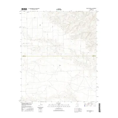
2016 Map of North Windmill
USGS Topo · Published 2016About this map
Wolf Flat anchors this landscape in the eastern Panhandle, where the high plains begin to break toward the canyonlands of the Wind River. Located just north of the Hall and Motley county line, the area is defined by a sparse network of ranch-to-market roads like FM 656 and numerous county routes including Co RD Aa and Co RD 7. These paths navigate the shifting elevation where the flat tableland gives way to the drainage basins of Kent Cr and Turkey Cr. Genealogical value is found at the Dreamland Cem in the northwestern corner, providing a fixed point of historical reference for the families of this ranching district. The survey illustrates the persistence of remote settlements like North Windmill, highlighting the enduring reliance on scattered water sources and vital road connections in this section of Texas.
Find a feature on this map
16 named features on this map. Tap any name to fly to it.
Don’t see what you’re looking for? This feature index may not catch every label — zoom into the map to look around manually.
Map Details
Editions of this 2016 North Windmill Map
This is the sole edition of this map. No revisions or reprints were ever made.
Other maps of this area

1954 · Plainview
USGS Topo · 1:250,000

1958 · Plainview
USGS Topo · 1:250,000

1967 · North Windmill
USGS Topo · 1:24,000

1967 · Cottonwood Camp
USGS Topo · 1:24,000

1967 · Tampico Siding
USGS Topo · 1:24,000

1967 · Hornica Creek
USGS Topo · 1:24,000

1967 · Turtle Hole Camp
USGS Topo · 1:24,000

1967 · Flomot
USGS Topo · 1:24,000

1967 · Turkey
USGS Topo · 1:24,000

1967 · Blue Tank Canyon
USGS Topo · 1:24,000