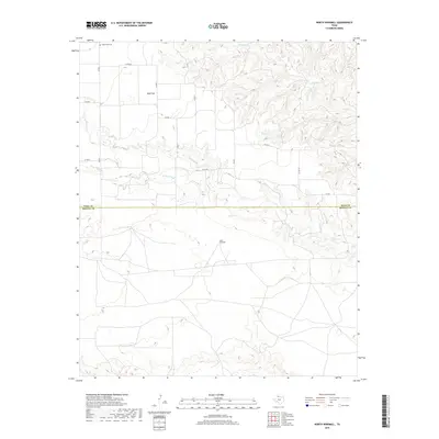
2019 Map of North Windmill
USGS Topo · Published 2019About this map
Wolf Flat sits in a rural stretch of West Texas where the high plains meet the intricate drainage systems of the Rolling Plains. This 2019 survey captures the transition across the Hall County and Motley County line, characterized by a complex network of seasonal watercourses. The deeply incised terrain of the Wind River and Turkey Creek provides a stark contrast to the flatter agricultural lands found near Farm to Market Road 656. Local history and genealogy interest is anchored by Dreamland Cemetery in the northwestern corner, while the presence of North Windmill reflects the enduring reliance on groundwater management in this ranching country. The road network, including County Road AA and County Road 7, follows a strict section-line grid that breaks only where the terrain becomes too broken by creek beds and erosion.
Find a feature on this map
16 named features on this map. Tap any name to fly to it.
Don’t see what you’re looking for? This feature index may not catch every label — zoom into the map to look around manually.
Map Details
Editions of this 2019 North Windmill Map
This is the sole edition of this map. No revisions or reprints were ever made.
Other maps of this area

1954 · Plainview
USGS Topo · 1:250,000

1958 · Plainview
USGS Topo · 1:250,000

1967 · North Windmill
USGS Topo · 1:24,000

1967 · Cottonwood Camp
USGS Topo · 1:24,000

1967 · Tampico Siding
USGS Topo · 1:24,000

1967 · Hornica Creek
USGS Topo · 1:24,000

1967 · Turtle Hole Camp
USGS Topo · 1:24,000

1967 · Flomot
USGS Topo · 1:24,000

1967 · Turkey
USGS Topo · 1:24,000

1967 · Blue Tank Canyon
USGS Topo · 1:24,000