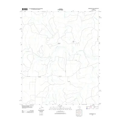
2012 Map of Northfield
USGS Topo · Published 2012About this map
Northfield serves as the primary settlement in this stretch of the Texas Panhandle, positioned where Ranch Road 656 meets Ranch Road 94. The landscape is defined by the winding course of the N Pease River, which carves through the terrain alongside prominent features like Housetop Canyon and Price Canyon. This 2012 survey illustrates a classic West Texas drainage pattern, with intermittent streams such as Chainey Mountain Cr, Bitter Lake Cr, and Joe Lake Cr feeding into the river system. The map documents the persistent rural character of the area, where a network of county roads including Co Road CC and Co Rd-253 provide access to the vast ranch lands that surround the Northfield community.
Find a feature on this map
15 named features on this map. Tap any name to fly to it.
Don’t see what you’re looking for? This feature index may not catch every label — zoom into the map to look around manually.
Map Details
Editions of this 2012 Northfield Map
This is the sole edition of this map. No revisions or reprints were ever made.
Other maps of this area

1954 · Plainview
USGS Topo · 1:250,000

1958 · Plainview
USGS Topo · 1:250,000

1966 · Fields Canyon
USGS Topo · 1:24,000

1966 · Cee Vee
USGS Topo · 1:24,000

1967 · Tell South
USGS Topo · 1:24,000

1967 · Tell North
USGS Topo · 1:24,000

1967 · Cottonwood Camp
USGS Topo · 1:24,000

1967 · Badger Nest Tank
USGS Topo · 1:24,000

1967 · Turtle Hole Camp
USGS Topo · 1:24,000

1967 · Northfield
USGS Topo · 1:24,000