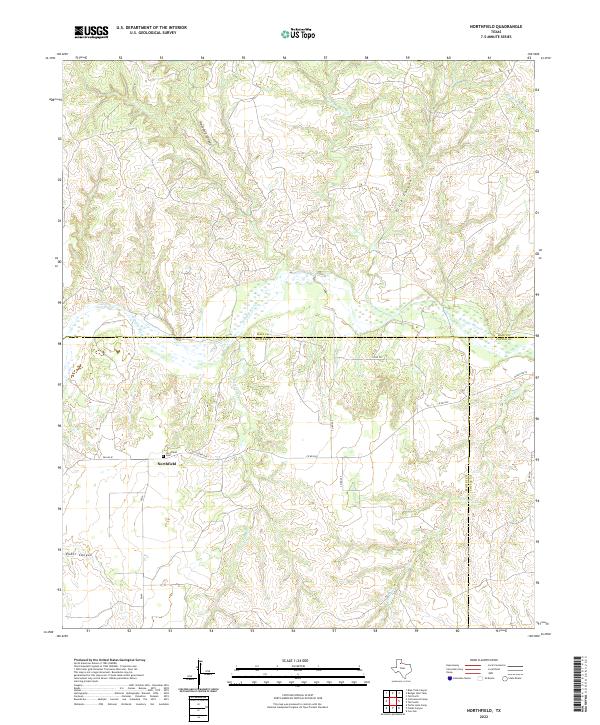
2022 Map of Northfield
USGS Topo · Published 2022About this map
Northfield sits as a quiet hub in this West Texas landscape where the boundaries of Hall, Motley, and Cottle counties converge. The topography is defined by the N Pease River and its complex network of seasonal drainage systems, including Bitter Lake Cr and Joe Lake Cr. The land is deeply incised by significant breaks and canyons, most notably Housetop Canyon to the north and Poker Canyon to the west.
Find a feature on this map
21 named features on this map. Tap any name to fly to it.
Don’t see what you’re looking for? This feature index may not catch every label — zoom into the map to look around manually.
Map Details
Editions of this 2022 Northfield Map
This is the sole edition of this map. No revisions or reprints were ever made.
Other maps of this area

1954 · Plainview
USGS Topo · 1:250,000

1958 · Plainview
USGS Topo · 1:250,000

1966 · Fields Canyon
USGS Topo · 1:24,000

1966 · Cee Vee
USGS Topo · 1:24,000

1967 · Tell South
USGS Topo · 1:24,000

1967 · Tell North
USGS Topo · 1:24,000

1967 · Cottonwood Camp
USGS Topo · 1:24,000

1967 · Badger Nest Tank
USGS Topo · 1:24,000

1967 · Turtle Hole Camp
USGS Topo · 1:24,000

1967 · Northfield
USGS Topo · 1:24,000