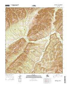
2014 Map of Norton Bay A-1 NE
USGS Topo · Published 2014About this map
Nulato Hills topography dominates this interior Alaska landscape, where elevation contours reveal the complex drainage patterns of the Rodo River. This 2014 survey documents a remote stretch of terrain defined by its water systems and solitary landmarks, characteristic of the unorganized territory in the western part of the state. A significant point of human interest is the Twentytwo Mile Cabin, a named structure positioned in the western portion of the map. This cabin represents the type of seasonal or trail-side shelter essential for navigation and survival in the Alaskan wilderness. The map is organized by the Public Land Survey System, showing several townships including t15s r3w and t15s r2w, which provide a formal grid over the seemingly chaotic river bends and mountain ridges.
Find a feature on this map
9 named features on this map. Tap any name to fly to it.
Don’t see what you’re looking for? This feature index may not catch every label — zoom into the map to look around manually.
Map Details
Editions of this 2014 Norton Bay A-1 NE Map
This is the sole edition of this map. No revisions or reprints were ever made.
Other maps of this area

1945 · Nulato
USGS Topo · 1:250,000

1948 · Norton Bay
USGS Topo · 1:250,000

1951 · Nulato
USGS Topo · 1:250,000

1951 · Norton Bay
USGS Topo · 1:250,000

1952 · Nulato B-6
USGS Topo · 1:63,360

1952 · Norton Bay B-1
USGS Topo · 1:63,360

1952 · Nulato
USGS Topo · 1:250,000

1952 · Nulato A-6
USGS Topo · 1:63,360
1954 · Norton Bay A-1
USGS Topo · 1:63,360

1955 · Norton Bay
USGS Topo · 1:250,000