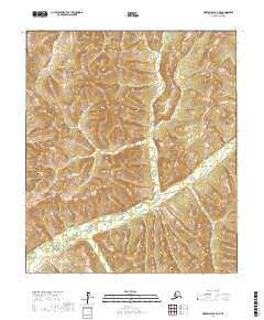
2017 Map of Norton Bay A-4 NE
USGS Topo · Published 2017About this map
The Nulato Hills dominate this portion of the Nome Census Area, characterized by a complex drainage system and high-elevation terrain. Most of the southern and central sections are defined by the winding course of Egavik Creek, which carves through the uplands. This 2017 survey reflects the remote and largely undeveloped nature of the Alaskan interior near Norton Bay, where natural landforms and hydrology remain the primary geographic features. The map provides precise detail on the many smaller tributaries, such as Egavik Cr, that feed into the larger creek system, illustrating the watershed patterns typical of this subarctic landscape.
Find a feature on this map
12 named features on this map. Tap any name to fly to it.
Don’t see what you’re looking for? This feature index may not catch every label — zoom into the map to look around manually.
Map Details
Editions of this 2017 Norton Bay A-4 NE Map
This is the sole edition of this map. No revisions or reprints were ever made.
Other maps of this area

1948 · Norton Bay
USGS Topo · 1:250,000

1950 · Norton Bay B-4
USGS Topo · 1:63,360

1950 · Norton Bay B-3
USGS Topo · 1:63,360

1950 · Norton Bay A-4
USGS Topo · 1:63,360

1950 · Norton Bay A-3
USGS Topo · 1:63,360

1951 · Norton Bay
USGS Topo · 1:250,000

1955 · Norton Bay
USGS Topo · 1:250,000
2014 · Norton Bay A-4 SW
USGS Topo · 1:25,000
2014 · Norton Bay B-4 SW
USGS Topo · 1:25,000
2014 · Norton Bay A-4 NW
USGS Topo · 1:25,000