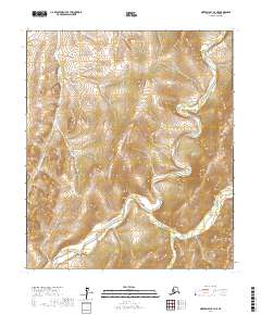
2017 Map of Norton Bay B-4 NE
USGS Topo · Published 2017About this map
The Shaktoolik River carves a winding path through the interior of the Seward Peninsula, defining the drainage patterns of this remote northern landscape. This 2017 survey illustrates the complex hydrology of the Norton Bay region, where several distinct tributaries contribute to the main river system. Notable among these are Diamond Cr in the northwest and Anakeksik Cr in the southeast, which cut through varied elevations marked by dense topographic contouring. The map serves as a primary record of the land divisions within the Nome Census Area, showing the intersections of several townships including t12s r10w and t13s r10w. With no roads or permanent settlements indicated, the map highlights the primary role of watercourses like Buck Cr as the dominant natural landmarks for navigation and land management in this Alaskan wilderness.
Find a feature on this map
11 named features on this map. Tap any name to fly to it.
Don’t see what you’re looking for? This feature index may not catch every label — zoom into the map to look around manually.
Map Details
Editions of this 2017 Norton Bay B-4 NE Map
This is the sole edition of this map. No revisions or reprints were ever made.
Other maps of this area

1948 · Norton Bay
USGS Topo · 1:250,000

1950 · Norton Bay B-4
USGS Topo · 1:63,360

1950 · Norton Bay B-3
USGS Topo · 1:63,360

1950 · Norton Bay C-3
USGS Topo · 1:63,360

1950 · Norton Bay C-4
USGS Topo · 1:63,360

1951 · Norton Bay
USGS Topo · 1:250,000

1955 · Norton Bay
USGS Topo · 1:250,000
2014 · Norton Bay B-4 SW
USGS Topo · 1:25,000
2014 · Norton Bay C-4 SW
USGS Topo · 1:25,000
2014 · Norton Bay B-4 NW
USGS Topo · 1:25,000