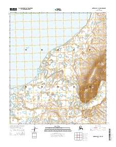
2014 Map of Norton Bay C-4 SW
USGS Topo · Published 2014About this map
The Bering Sea coastline defines this portion of the Norton Bay region, where coastal lowlands meet the tidal reaches of the Ungalik River. The landscape is characterized by a complex network of small lakes and ponds typical of the Alaskan tundra, with the river meandering through the center of the sheet towards the coast. This 2014 survey records the presence of the Inglutaiak River Road and several local routes such as Sha2006 and Sha2007, providing essential overland connections in an otherwise water-dominant environment. In the southeastern corner, the terrain rises significantly, with higher elevations drained by Diamond Cr. The map captures the interface between the marine influence of the bay and the interior drainages of First Cr, showing the hydrology and infrastructure of the Nome region at the start of the 21st century.
Find a feature on this map
12 named features on this map. Tap any name to fly to it.
Don’t see what you’re looking for? This feature index may not catch every label — zoom into the map to look around manually.
Map Details
Editions of this 2014 Norton Bay C-4 SW Map
This is the sole edition of this map. No revisions or reprints were ever made.
Other maps of this area

1948 · Norton Bay
USGS Topo · 1:250,000

1950 · Norton Bay B-5
USGS Topo · 1:63,360

1950 · Norton Bay B-4
USGS Topo · 1:63,360

1950 · Norton Bay C-5
USGS Topo · 1:63,360

1950 · Norton Bay C-4
USGS Topo · 1:63,360

1951 · Norton Bay
USGS Topo · 1:250,000

1955 · Norton Bay
USGS Topo · 1:250,000
2014 · Norton Bay C-4 NW
USGS Topo · 1:25,000
2014 · Norton Bay B-5 NE
USGS Topo · 1:25,000
2014 · Norton Bay C-4 NE
USGS Topo · 1:25,000