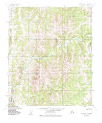
1950 Map of Norton Bay D-3
USGS Topo · Published 1985About this map
The Ungalik River provides the central geographic focus of this mid-century survey, winding through an undeveloped landscape that was mapped primarily through photogrammetric methods from 1950 aerial photography. The terrain is characterized by intricate elevation contours, showing the varied drainage patterns of the Seward Peninsula’s interior south of the Kateel River Meridian. Because the land lines shown were predetermined by the Bureau of Land Management but remained unsurveyed and unmarked at the time of publication, the map represents a transitional period in Alaskan land administration. It serves as a precise record of the natural topography and waterway alignment before significant human intervention or modern development altered the drainage basin of the Ungalik River.
Find a feature on this map
1 named feature on this map. Tap any name to fly to it.
Don’t see what you’re looking for? This feature index may not catch every label — zoom into the map to look around manually.
Map Details
Editions of this 1950 Norton Bay D-3 Map
2 editions found
Other maps of this area

1948 · Norton Bay
USGS Topo · 1:250,000

1950 · Norton Bay D-4
USGS Topo · 1:63,360

1950 · Norton Bay C-3
USGS Topo · 1:63,360

1950 · Norton Bay D-3
USGS Topo · 1:63,360

1950 · Norton Bay C-4
USGS Topo · 1:63,360

1951 · Candle
USGS Topo · 1:250,000

1951 · Norton Bay
USGS Topo · 1:250,000

1953 · Norton Bay C-2
USGS Topo · 1:63,360

1954 · Candle A-2
USGS Topo · 1:63,360

1954 · Norton Bay D-2
USGS Topo · 1:63,360