
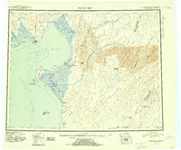
1951 Map of Norton Bay
USGS Topo · Published 1951About this map
Norton Bay and the adjacent Norton Sound define this coastal landscape, where the sea meets a network of interior rivers and rugged highlands. The 1951 geography highlights a remote logistics network of essential shelters, including the Shaktolik Roadhouse and several isolated outposts like Old Woman Cabin and Tenmile Cabin. These features trace the historical overland routes through the Kaltag Mountains and toward the Yukon drainage via the Portage. Cultural and administrative boundaries are prominent, such as the Norton Bay Native Res and the Reindeer Reservation on the peninsula near Cape Denbigh. The map documents a landscape of essential survival hubs, from the Shaktolik Landing Area to the Foothills Roadhouse, situated between the tide-flats and the peaks of Debauch Mountain.
Find a feature on this map
46 named features on this map. Tap any name to fly to it.
Don’t see what you’re looking for? This feature index may not catch every label — zoom into the map to look around manually.
Map Details
Editions of this 1951 Norton Bay Map
2 editions found
Other maps of this area

1945 · Nulato
USGS Topo · 1:250,000

1948 · Norton Bay
USGS Topo · 1:250,000

1950 · Bendeleben A-1
USGS Topo · 1:63,360

1950 · Norton Bay D-6
USGS Topo · 1:63,360

1950 · Bendeleben
USGS Topo · 1:250,000

1950 · Norton Bay B-5
USGS Topo · 1:63,360

1950 · Norton Bay D-5
USGS Topo · 1:63,360

1950 · Solomon C-1
USGS Topo · 1:63,360

1950 · Norton Bay B-4
USGS Topo · 1:63,360

1950 · Norton Bay C-6
USGS Topo · 1:63,360