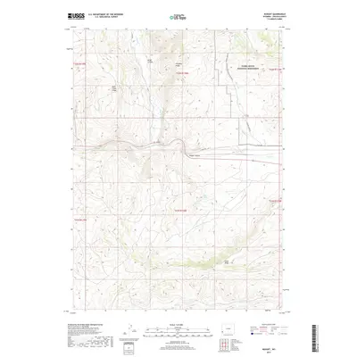
2017 Map of Nugget
USGS Topo · Published 2017About this map
Nugget sits at a junction of valley routes in the high plains of Lincoln County, defining a localized landscape where transport and water converge. The settlement is positioned along the winding course of Rock Cr, which serves as the primary drainage through the area's complex topography. This 2017 U.S. Geological Survey representation highlights the enduring importance of these corridors for local movement through the basin. While the map is relatively sparse of named settlements, the presence of Nugget at this specific waterway crossing suggests a history of strategic location for ranching or railroad operations common to this region of Wyoming.
Find a feature on this map
2 named features on this map. Tap any name to fly to it.
Don’t see what you’re looking for? This feature index may not catch every label — zoom into the map to look around manually.
Map Details
Editions of this 2017 Nugget Map
This is the sole edition of this map. No revisions or reprints were ever made.
Other maps of this area

1954 · Sage
USGS Topo · 1:62,500

1954 · Ogden
USGS Topo · 1:250,000

1954 · Kemmerer
USGS Topo · 1:62,500

1958 · Ogden
USGS Topo · 1:250,000

1960 · Ogden
USGS Topo · 1:250,000

1962 · Bell Butte NE
USGS Topo · 1:24,000

1962 · Windy Point
USGS Topo · 1:24,000

1962 · Warfield Creek
USGS Topo · 1:24,000
1979 · Kemmerer
USGS Topo · 1:100,000
1985 · The Rock Slide
USGS Topo · 1:24,000