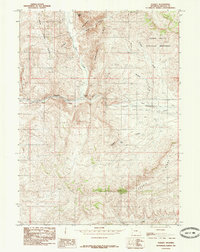
1985 Map of Nugget
USGS Topo · Published 1985About this map
The settlement of Nugget marks a key point in this western Wyoming landscape where the Tunp Range and Rock Creek Ridge converge. Located along the path of Twin Creek, the area is defined by sharp topographic shifts through Nugget Canyon and Millet Canyon. To the northeast, the presence of Fossil Butte National Monument and the massive Fossil Butte indicate a region shaped by significant geologic history. The landscape is also dotted with curiously named water features like Smallpox Creek and Bullpen Creek, alongside thermal or mineral indicators such as Sulphur Spring. Evidence of former transportation infrastructure is preserved in the Old Railroad Grade that winds through the valley, tracing a historical route alongside the modern flow of water and travel through Lincoln County.
Find a feature on this map
20 named features on this map. Tap any name to fly to it.
Don’t see what you’re looking for? This feature index may not catch every label — zoom into the map to look around manually.
Map Details
Editions of this 1985 Nugget Map
This is the sole edition of this map. No revisions or reprints were ever made.
Other maps of this area

1954 · Sage
USGS Topo · 1:62,500

1954 · Ogden
USGS Topo · 1:250,000

1954 · Kemmerer
USGS Topo · 1:62,500

1958 · Ogden
USGS Topo · 1:250,000

1960 · Ogden
USGS Topo · 1:250,000

1962 · Bell Butte NE
USGS Topo · 1:24,000

1962 · Windy Point
USGS Topo · 1:24,000

1962 · Warfield Creek
USGS Topo · 1:24,000
1979 · Kemmerer
USGS Topo · 1:100,000
1985 · The Rock Slide
USGS Topo · 1:24,000