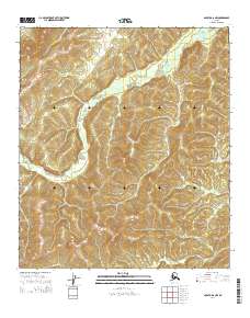
2014 Map of Nulato A-6 NW
USGS Topo · Published 2014About this map
Nulato Hills dominate this portion of the Alaskan interior, presenting a landscape defined by significant elevation changes and drainage patterns. The Rodo River meanders across the northern and central sections, carving through the terrain as it flows toward the Yukon basin. In the southern reaches, Poison Cr marks a distinct drainage area near the boundary of Township 16 South. This 2014 survey illustrates the topographic complexity of the region, where the heights of the Nulato Hills influence the path of these waterways. The map serves as a record of the remote wilderness and its natural boundaries during the early twenty-first century, showing the intersection of several township and range divisions within the Yukon-Koyukuk region.
Find a feature on this map
12 named features on this map. Tap any name to fly to it.
Don’t see what you’re looking for? This feature index may not catch every label — zoom into the map to look around manually.
Map Details
Editions of this 2014 Nulato A-6 NW Map
This is the sole edition of this map. No revisions or reprints were ever made.
Other maps of this area

1945 · Nulato
USGS Topo · 1:250,000

1948 · Norton Bay
USGS Topo · 1:250,000

1951 · Nulato
USGS Topo · 1:250,000

1951 · Norton Bay
USGS Topo · 1:250,000

1952 · Nulato B-6
USGS Topo · 1:63,360

1952 · Norton Bay B-1
USGS Topo · 1:63,360

1952 · Nulato
USGS Topo · 1:250,000

1952 · Nulato A-6
USGS Topo · 1:63,360
1954 · Norton Bay A-1
USGS Topo · 1:63,360

1955 · Norton Bay
USGS Topo · 1:250,000