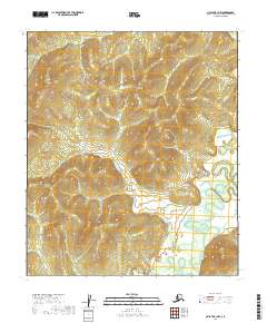
2019 Map of Nulato B-1 NW
USGS Topo · Published 2019About this map
The Yuki River meanders through the landscape of the Yukon-Koyukuk region, creating a complex network of oxbow lakes and side channels in the southeastern portion of this terrain. This interior Alaskan landscape is defined by the heavy winding of the river as it flows across a relatively low-lying floodplain, flanked by significant elevation changes in the surrounding hills. The map provides a look at the natural drainage patterns and the survey boundaries of t11s r12e and t13s r13e among other townships. As a modern record of this unpopulated wilderness area, the survey focuses on the physical topography and the intricate hydrological movements of the Yuki River valley before it joins larger regional water systems.
Find a feature on this map
7 named features on this map. Tap any name to fly to it.
Don’t see what you’re looking for? This feature index may not catch every label — zoom into the map to look around manually.
Map Details
Editions of this 2019 Nulato B-1 NW Map
This is the sole edition of this map. No revisions or reprints were ever made.
Other maps of this area

1945 · Nulato
USGS Topo · 1:250,000

1951 · Nulato
USGS Topo · 1:250,000

1952 · Nulato C-1
USGS Topo · 1:63,360

1952 · Nulato B-2
USGS Topo · 1:63,360

1952 · Nulato B-1
USGS Topo · 1:63,360

1952 · Nulato C-2
USGS Topo · 1:63,360

1952 · Nulato
USGS Topo · 1:250,000
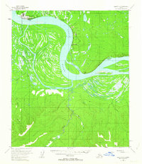
1953 · Nulato C-2
USGS Topo · 1:63,360
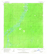
1953 · Nulato B-1
USGS Topo · 1:63,360

1964 · Nulato
USGS Topo · 1:250,000