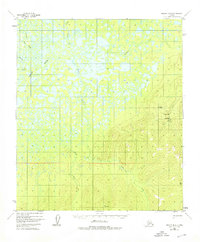
1952 Map of Nulato B-4
USGS Topo · Published 1976About this map
The Khotol River and Kaiyuh Slough dominate the western lowlands of this interior Alaskan landscape, characterized by a complex network of wetlands and wandering watercourses. Traces of human activity are concentrated in the east, where Camp Creek and its associated mine appear alongside a remote Landing Strip (Skis Only). The transition from the marshy flats near Wounded Cub Creek to the rising terrain marked by Vabm Eddy illustrates the isolation of the region in the early 1950s.
Find a feature on this map
14 named features on this map. Tap any name to fly to it.
Don’t see what you’re looking for? This feature index may not catch every label — zoom into the map to look around manually.
Map Details
Editions of this 1952 Nulato B-4 Map
2 editions found
Other maps of this area

1945 · Nulato
USGS Topo · 1:250,000

1951 · Nulato
USGS Topo · 1:250,000

1952 · Nulato A-5
USGS Topo · 1:63,360

1952 · Nulato C-3
USGS Topo · 1:63,360

1952 · Nulato C-4
USGS Topo · 1:63,360

1952 · Nulato A-4
USGS Topo · 1:63,360

1952 · Nulato B-5
USGS Topo · 1:63,360

1952 · Nulato B-3
USGS Topo · 1:63,360

1952 · Nulato B-4
USGS Topo · 1:63,360

1952 · Nulato A-3
USGS Topo · 1:63,360