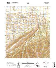
2017 Map of Nulato C-3 SE
USGS Topo · Published 2017About this map
Bishop Cr meanders through this interior Alaska landscape, defining the drainage patterns within the Nulato C-3 SE quadrangle. The terrain transitions from the low-lying wetland complexes in the northern sections to the increasingly complex elevations in the south. This 2017 survey records the untouched character of the Yukon-Koyukuk region, where Kinkaid Cr flows through the eastern reaches of the sheet. The map is primarily characterized by its topographical detail, illustrating the remote and rugged nature of the subarctic wilderness as it appeared in the early 21st century. The absence of roads or permanent settlements within these townships emphasizes the isolation of this part of the Alaska interior, making it a critical reference for understanding the natural hydrology and landform morphology of the area.
Find a feature on this map
6 named features on this map. Tap any name to fly to it.
Don’t see what you’re looking for? This feature index may not catch every label — zoom into the map to look around manually.
Map Details
Editions of this 2017 Nulato C-3 SE Map
This is the sole edition of this map. No revisions or reprints were ever made.
Other maps of this area

1945 · Nulato
USGS Topo · 1:250,000

1951 · Nulato
USGS Topo · 1:250,000

1952 · Nulato B-2
USGS Topo · 1:63,360

1952 · Nulato C-3
USGS Topo · 1:63,360

1952 · Nulato C-2
USGS Topo · 1:63,360

1952 · Nulato B-3
USGS Topo · 1:63,360

1952 · Nulato
USGS Topo · 1:250,000
1953 · Nulato C-2
USGS Topo · 1:63,360

1964 · Nulato
USGS Topo · 1:250,000
2017 · Nulato C-3 NW
USGS Topo · 1:25,000