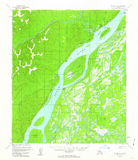
1953 Map of Nulato C-5
USGS Topo · Published 1962About this map
The Yukon River dominates this mid-century Alaskan landscape, serving as the primary artery for travel and communication near Nulato. The settlement is marked by a Landing Strip and a Radio Tower (Aban'd), illustrating the community's reliance on aviation and radio in the interior. An Abandoned Telegraph Line traces a winding path along the riverbanks, a remnant of earlier infrastructure that once connected these isolated outposts.
Find a feature on this map
25 named features on this map. Tap any name to fly to it.
Don’t see what you’re looking for? This feature index may not catch every label — zoom into the map to look around manually.
Map Details
Editions of this 1953 Nulato C-5 Map
2 editions found
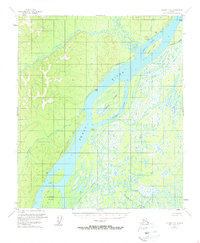
Other maps of this area

1945 · Nulato
USGS Topo · 1:250,000

1951 · Nulato
USGS Topo · 1:250,000

1952 · Nulato B-6
USGS Topo · 1:63,360

1952 · Nulato D-5
USGS Topo · 1:63,360

1952 · Nulato C-4
USGS Topo · 1:63,360

1952 · Nulato B-5
USGS Topo · 1:63,360

1952 · Nulato D-4
USGS Topo · 1:63,360

1952 · Nulato B-4
USGS Topo · 1:63,360

1952 · Nulato C-6
USGS Topo · 1:63,360

1952 · Nulato C-5
USGS Topo · 1:63,360