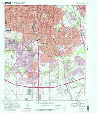
1958 Map of Oak Cliff
USGS Topo · Published 1982About this map
The Oak Cliff district of Dallas shows its late 1950s expansion, characterized by a dense network of suburban schools and churches. This post-war era is marked by the presence of significant infrastructure like the Veterans Hospital and the Redbird Airport in the southwest. The landscape is defined by the Trinity River and its tributaries, including Fivemile Creek and Cedar Creek, which carved green spaces like Kiest Park and Marsalis Park out of the developing residential blocks.
Find a feature on this map
87 named features on this map. Tap any name to fly to it.
Don’t see what you’re looking for? This feature index may not catch every label — zoom into the map to look around manually.
Map Details
Editions of this 1958 Oak Cliff Map
5 editions found
Other maps of this area

1891 · Dallas
USGS Topo · 1:125,000

1893 · Dallas
USGS Topo · 1:125,000

1931 · Carrollton
USGS Topo · 1:62,500

1954 · Dallas
USGS Topo · 1:250,000

1957 · White Rock Lake
USGS Topo · 1:24,000

1958 · Dallas
USGS Topo · 1:250,000

1958 · Hutchins
USGS Topo · 1:24,000

1958 · Oak Cliff
USGS Topo · 1:24,000

1958 · Dallas
USGS Topo · 1:24,000

1958 · White Rock Lake
USGS Topo · 1:24,000