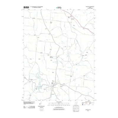
2010 Map of Oak Hill
USGS Topo · Published 2010About this map
Oak Hill serves as the primary hub in this southern Ohio landscape, surrounded by a high concentration of family and community cemeteries that speak to the deep generational roots in Jackson County. The terrain is defined by the winding paths of Symmes Creek and Salt Lick Creek, with Jackson Lake providing a significant water feature in the southwest. Small crossroads and rail-adjacent settlements such as Keystone, Winchester, and Camba are scattered throughout the quadrangle, connected by an intricate network of township roads like Franklin Valley Rd and Keystone Station Rd. The presence of the James A Rhodes Airport and the Oak Hill Upground Reservoir Dam indicates a mix of modern infrastructure and essential water management. Genealogists will find a wealth of records here, from the Congregational Cemetery near the center of town to smaller, family-named sites like Buckley Cemetery and Webb Cemetery.
Find a feature on this map
93 named features on this map. Tap any name to fly to it.
Don’t see what you’re looking for? This feature index may not catch every label — zoom into the map to look around manually.
Map Details
Editions of this 2010 Oak Hill Map
This is the sole edition of this map. No revisions or reprints were ever made.
Other maps of this area

1905 · Wilkesville
USGS Topo · 1:62,500

1906 · Bidwell
USGS Topo · 1:62,500

1908 · Bidwell
USGS Topo · 1:62,500

1908 · Wilkesville
USGS Topo · 1:62,500

1912 · Oak Hill
USGS Topo · 1:62,500

1913 · Jackson
USGS Topo · 1:62,500

1944 · Jackson
USGS Topo · 1:62,500

1947 · Columbus
USGS Topo · 1:250,000

1957 · Huntington
USGS Topo · 1:250,000

1960 · Huntington
USGS Topo · 1:250,000