Loading...
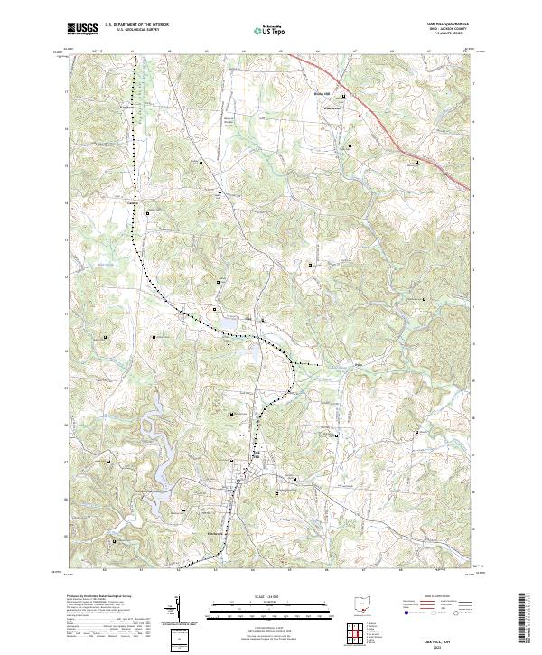
Loading map...2023 Map of Oak Hill
USGS Topo · Published 2023About this map
Oak Hill and the surrounding township lands of Jackson County are defined by a complex network of stream valleys and agricultural ridges. The landscape is oriented along the Franklin Valley, where the community of Keystone sits near the headwaters of Salt Lick Creek. This 2023 survey illustrates the enduring settlement patterns of the region, where numerous small communities like Camba, Clay, and Pyro are connected by a dense web of township and county roads.
Find a feature on this map
125 named features on this map. Tap any name to fly to it.
Don’t see what you’re looking for? This feature index may not catch every label — zoom into the map to look around manually.
Map Details
Date Portrayed2023
Date Published2023
PublisherU.S. Geological Survey
Map TypeTopographic
Scale1:24000
Physical Dimensions24 x 29 inches
Editions of this 2023 Oak Hill Map
This is the sole edition of this map. No revisions or reprints were ever made.
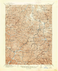
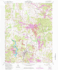
Historical Maps of Pyro Through Time
3 maps found
Featured Locations
Source Details
SourceU.S. Geological Survey
CopyrightPublic Domain